
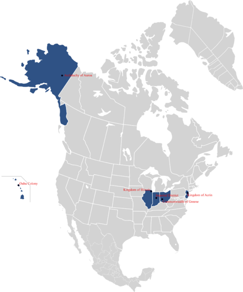
GeographyThe territorial claims of Occidia is defined as the collection of all land owned or resided upon by the households of the Empire, and shall change relative to the most recent census accordingly. Other important aspect is the Sphere of Influence that, as defined by the Delveran Constitution, shall be determined by a vote of the Council of Junkers.
Occidia is surrounded by the United States on all sides. Previous land claims had the Empire additionally bordering the Grand Republic of Delvera, and the Kingdom of Callaway, with the Ohio and Missouri rivers collectively forming the largest portions of the Southern and Eastern border between the two nations. Since the adoption of the third constitution, the State had only laid claim to the lands and properties directly owned by either the citizens or the government directly. The territories of the Empire, in accordance with the Constitution, was comprised almost exclusively of urban dwellings. The largest population is in the area around the city of Dayton, Ohio. |
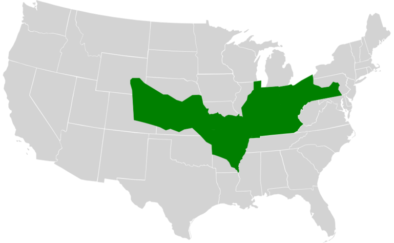
North American Confederation maximum extension, 2019.
|
SPHERE OF INFLUENCE
|
The Sphere of Influence for Occidia established the western border is determined by the Mississippi, Illinois, and Fox Rivers; following all three from the Kentucky-Tennessee borders easternmost interaction with the Mississippi to the Wisconsin border. The northern border is determined by the Wisconsin-Illinois border to the Michigan border, which turns south to the Michigan-Indiana border and the Michigan-Ohio border before running into the Canadian border and the Pennsylvania-New York-Canadian border.
The eastern border follows the Pennsylvania-New York border south until it runs into the French Creek. The border then follows the French Creek until it meets the Allegheny, then follows the Allegheny River and the Mahoning Creek to its source. The claim then heads east from the source until it runs into the Susquehanna River which it follows until it reaches the Pennsylvania-Maryland border. The southern border heads west along the Pennsylvania-Maryland border until it reaches the Ohio River, cutting straight through the northernmost part of West Virginia. The border then follows the Ohio River south along the Ohio-West Virginia border, then the Kentucky-Virginia border before turning west at the Kentucky-Tennessee border. |
Delveran Sphere of Influence, 2020.
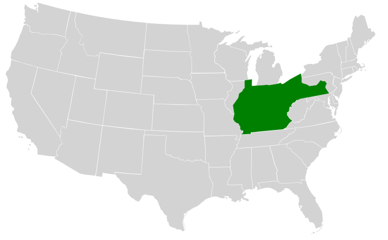
Occidian sphere of influence, 2020.
|
